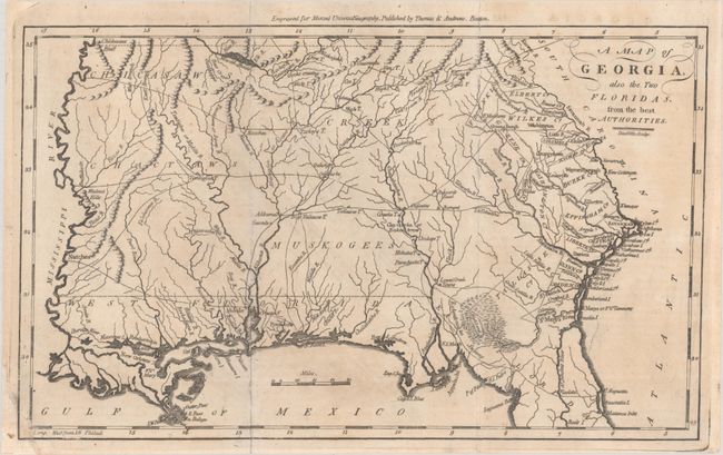
Subject: Southeastern United States, Georgia
Period: 1796 (circa)
Publication: The American Universal Geography
Color: Black & White
Size:
12.1 x 7.4 inches
30.7 x 18.8 cm
This is an early American map depicting Georgia Territory extending from the Atlantic seaboard to the Mississippi River, with East and West Florida along the Gulf Coast. Most of the interior is dominated by various Indian tribes, including the Chickasaws, Creeks, Choctaws, and Muskogees with several prominent villages located. Fifteen early counties are shown along the Atlantic coast and the Savannah River. Several trading paths are noted in the west. Mobile, Pensacola, and New Orleans are noted. Engraved by Amos Doolittle and published by Thomas & Andrews, Boston.
References: McCorkle (18th C. Geography Books) #304-15; Wheat & Brun #614.
Condition: B+
A nice impression issued folding with a small chip at bottom left that has been replaced with a section of border from another map, roughly contemporaneous. There is minor offsetting, and the folds are partially reinforced with archival tape on verso.