Subject: Maryland & Delaware
Period: 1796-1822 (circa)
Publication:
Color:
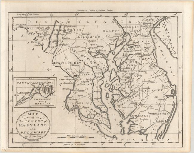
A. Map of the States of Maryland and Delaware, by (Rev.) Jedidiah Morse, from The American Universal Geography, circa 1796, black & white (9.7 x 7.5"). This is the first state of this detailed map that includes all of the Chesapeake Bay and locates Washington City. At left is an inset, The Western Part of Maryland, that names the Potomack River and several mountain ridges. Counties are named and delineated. The map also shows towns, roads, topography, and good watershed detail. Drawn by James Denison, engraved by Amos Doolittle, and published by Thomas & Andrews, Boston. References: McCorkle (18th C. Geography Books) #304-10; Wheat & Brun #514. Condition: A sharp impression issued folding with minor foxing at bottom. (A)
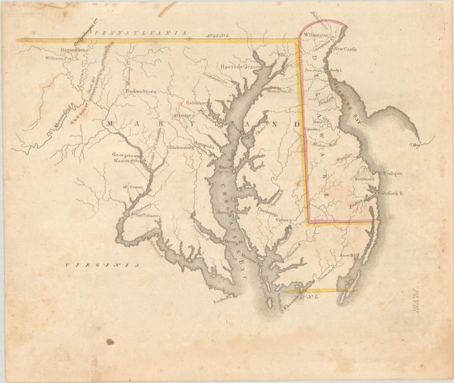
B. [Untitled - Maryland & Delaware], by Luke Drury, published 1822, hand color (9.5 x 6.9"). This map of Maryland and Delaware was originally published in Drury's scarce early American geography book A Geography for Schools... (1822). The District of Columbia is depicted as a square with only Georgetown and Washington identified to the east of the Potomac. The map design is simple overall, with sparse detail aside from watershed and place names. Mt. Vernon, Port Tobacco, Baltimore, Annapolis, Havre de Grace, Rehoboth Beach, Dover, and Wilmington are all located. Plate VIII. Reference: Phillips (Atlases) #279. Condition: There is scattered foxing and light dampstaining confined to the bottom sheet edge. (B)
References:
Condition:
See description above.