Catalog Archive
Auction 202, Lot 664
"Carte de la Partie Superieure de l'Inde en deca du Gange, Comprise Entre la Cote du Concan et Celle d'Orixa, avec l'Empire du Mogol, le Bengale, le Re. d'Asham...", Bonne, Rigobert
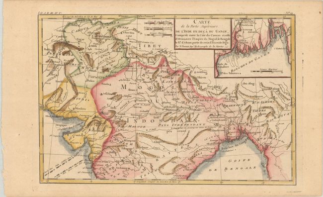
Subject: Northern India
Period: 1780 (circa)
Publication: Atlas de Toutes les Parties Connues du Globe Terrestre
Color: Hand Color
Size:
12.7 x 8.4 inches
32.3 x 21.3 cm
Download High Resolution Image
(or just click on image to launch the Zoom viewer)
(or just click on image to launch the Zoom viewer)