Subject: Russia in Asia
Period: 1788-93 (published)
Publication:
Color: Black & White
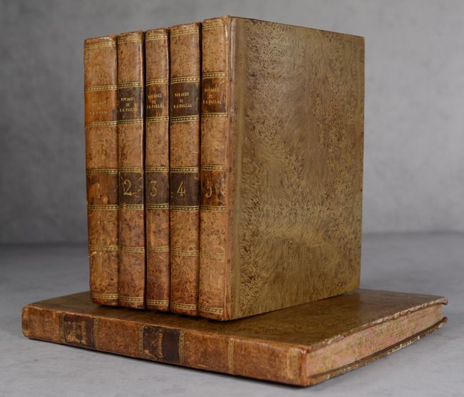
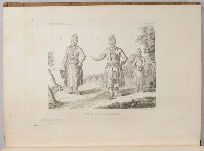
This superb set is comprised of 5 text volumes and one atlas volume to recount the expeditions of Peter Simon Pallas through the Russian Empire. Pallas (1741-1811) was born in Prussia and studied natural sciences. In 1767 he received an invitation from Catherine II of Russia for a position at the Academy of Sciences in St. Petersburg. In his role, he was tasked with observing the passage of Venus across Siberia. During his six-year expedition, he also conducted a scientific exploration of Russia and Central Asia, extending from the shores of the Caspian Sea to Lake Baikal and the confines of the Chinese border. He recorded the geology, flora, fauna, peoples, costumes, and architecture he discovered during his travels. His work was first documented in a German edition (Reise durch verschiedene Provinzen des Russischen Reichs) published in St. Petersburg in 1771. This is the first French translation, which was completed by Gauthier de La Peyronie and published in Paris by Maradan.
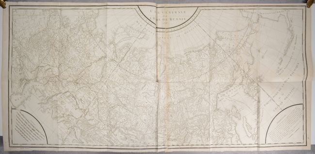
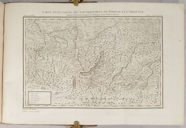
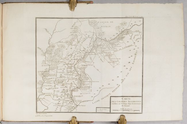
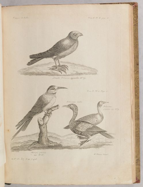
The atlas volume includes 11 maps and 97 engraved plates, 32 of which are folding. The first map is a large engraved map on 2 sheets, Carte Generale de l'Empire de Russie, engraved by P. F. Tardieu (47 x 22"). It covers the entire Russian Empire from the Black Sea to Kamtschatka and extends to include a portion of mainland Alaska and the Aleutian Islands based upon Russian sources. The map marks the routes traveled by Pallas. Several notations are presented along the Arctic Ocean including one along the northern coastline of Nova Zembla concerning the Dutch expedition led by Willem Barents in 1594-96.
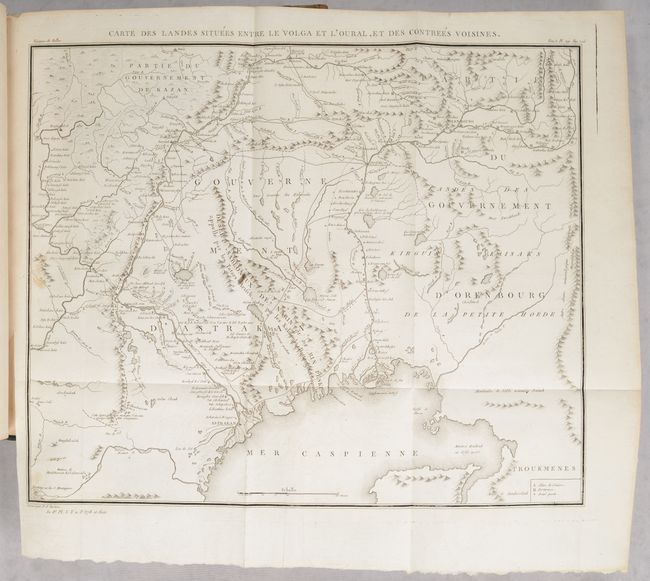
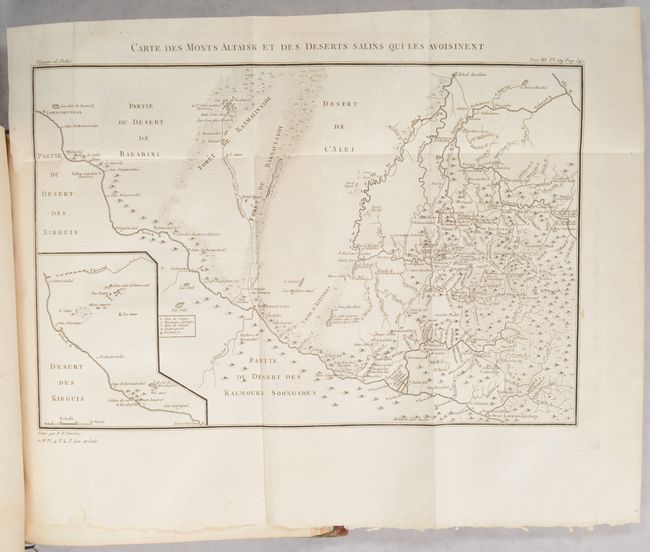
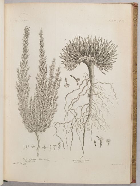
The additional maps depicts smaller regions in more detail. The engraved plates include numerous botanical images, as well as images of animals, buildings, monuments, idols, and costumed figures. The quarto text volumes measure 8.3 x 10.5" and the small folio atlas volume measures 10.4 x 13.9". Hardbound in contemporary mottled leather spines with mottled paper-covered boards. The spines have brown leather title labels with gilt tooling and titling. Marbled endpapers and marbled edges. This is an incredibly thorough work on Russia during the 18th century.
References:
Condition: B+
The maps and engravings are in very good condition, mostly clean and bright, with occasional toning or mis-folds. The large folding map of Russia has a couple of short tears near the fold intersections, light offsetting, light toning where the two sheets were glued together, and a 5" tear near Kamchatka that has been professionally repaired. The 5 text volumes are in very good condition with occasional scattered foxing or toning. There is an old stamp (Bibliotheque de Laplanche) on the title page of each volume. In Vol. 4 there are archival repairs to short tears to the last 5 leaves in the volume. The covers are in excellent condition and show very minor wear, except for the atlas volume which has some scuffing and a tear to the back cover.