Subject: Northern Africa
Period: 1597-98 (circa)
Publication:
Color: Black & White
Claudius Ptolemy was a mathematician, astronomer and geographer who worked in Alexandria, then a part of the Roman Empire, in the 2nd century AD. One of the most learned and influential men of his time, his theories dominated both astronomy and geography for nearly 1500 years. His writings were kept alive by Arabic scholars during the Middle Ages and reemerged in Europe during the Renaissance. The birth of printing led to wide dissemination of his great works on astronomy and geography. There were a number of editions of his Geographia beginning in 1477. These early editions contained maps based on his original writings, known as Ptolemaic maps. As geographic knowledge increased with the explorations of Columbus, Magellan, Cabot and others, maps of the New World were added, and maps of the Old World were revised. Ptolemy's Geographia continued to be revised and published by some of the most important cartographers including Martin Waldseemuller, Sebastian Munster, Giacomo Gastaldi, Jodocus Hondius, and Gerard Mercator (whose last edition was published in 1730).
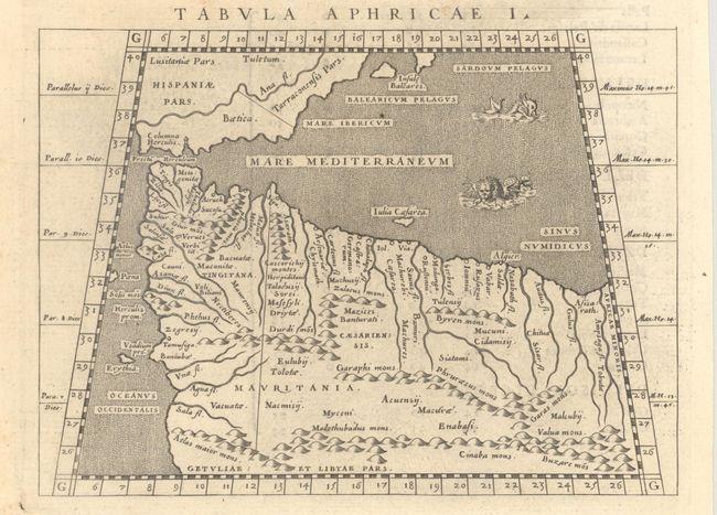
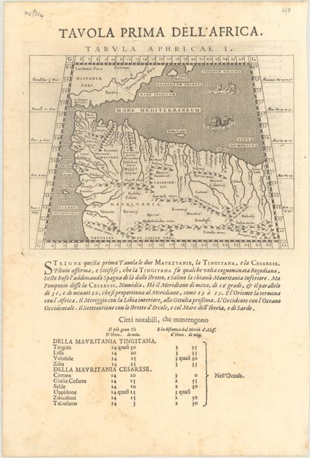
A. Tabula Aphricae I, from Geografia cioe Descrittione Universale della Terra..., circa 1598 (6.8 x 5.0"). This small Ptolemaic map depicts the northern part of Africa and the southern tip of Spain. It shows large rivers, convoluted mountain ranges, and ancient cities. The Columna Herculis is located in Spain. There are a couple interesting sea monsters in the stippled sea. From an edition printed by the Galignani brothers, published in either 1598 or 1621. On a sheet of Italian text measuring 7.9 x 11.6". Reference: Mickwitz & Miekkavaara #226-12. Condition: A crisp impression with light foxing in the margins.
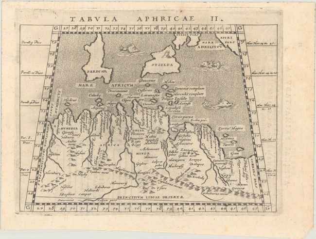
B. Tabula Aphricae II, from Geographiae tum Veteris, tum Novae..., circa 1597 (6.7 x 4.9"). Another miniature Ptolemaic map, this one covering portions of Algeria, Tunisia, and Libya and extending to include the islands of Sicily and Sardinia. The map identifies rivers and mountain ranges in the vicinity, and is decorated by a trio of sea monsters in the stippled sea and an erupting Mount Etna in Sicily. Latin text on verso. Reference: Mickwitz & Miekkavaara #222-14. Condition: A nice impression with a few spots in the margins.
References:
Condition: A
See description above.