Subject: Germany
Period: 1729 (published)
Publication: Introductionis in Universam Geographiam
Color: Hand Color
Size:
9.9 x 7.9 inches
25.1 x 20.1 cm
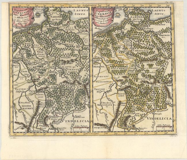
Two maps, on one sheet, covering the same area (nearly all of present day Germany). The maps show subtle differences in the political boundaries and place names during the Roman period, under the administration of Caesar and Trajan. An interesting comparison for the collector of German cartography.
Cluver's Introductio in Universam Geographicam was a popular atlas, appearing in over 45 editions during a 100-year period. The first edition was published without maps in the 1620s, and the first edition to include maps was published circa 1641. The various editions were published in different cities throughout Europe, including Amsterdam, Nuremberg, and London. This map is from an Amsterdam edition, edited by Bruzen de la Martiniere with maps by Jan Wolters and four newly engraved maps after Delisle.
References: Shirley (BL Atlases) T.CLUV-8b.
Condition: A
A dark impression on a bright sheet, issued folding with a narrow top margin. A short tear at top left has been archivally repaired with old paper on verso.