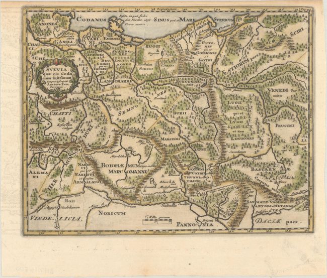
Subject: Central Europe
Period: 1729 (published)
Publication: Introductionis in Universam Geographiam
Color: Hand Color
Size:
9.8 x 7.7 inches
24.9 x 19.6 cm
Densely engraved small map showing the ancient Germanic tribes, covering the region of present-day Germany, Poland, Czech Republic, and Slovak Republic, extending south to the Danube River. It is adorned with a wreath-style title cartouche.
Cluver's Introductio in Universam Geographicam was a popular atlas, appearing in over 45 editions during a 100-year period. The first edition was published without maps in the 1620s, and the first edition to include maps was published circa 1641. The various editions were published in different cities throughout Europe, including Amsterdam, Nuremberg, and London. This map is from an Amsterdam edition, edited by Bruzen de la Martiniere with maps by Jan Wolters and four newly engraved maps after Delisle.
References: Shirley (BL Atlases) T.CLUV-8b.
Condition: A
A dark impression with offsetting in the left margin and light toning in the narrow top margin.