Subject: Northeastern Spain
Period: 1700 (circa)
Publication:
Color: Hand Color
Size:
20.5 x 14.7 inches
52.1 x 37.3 cm
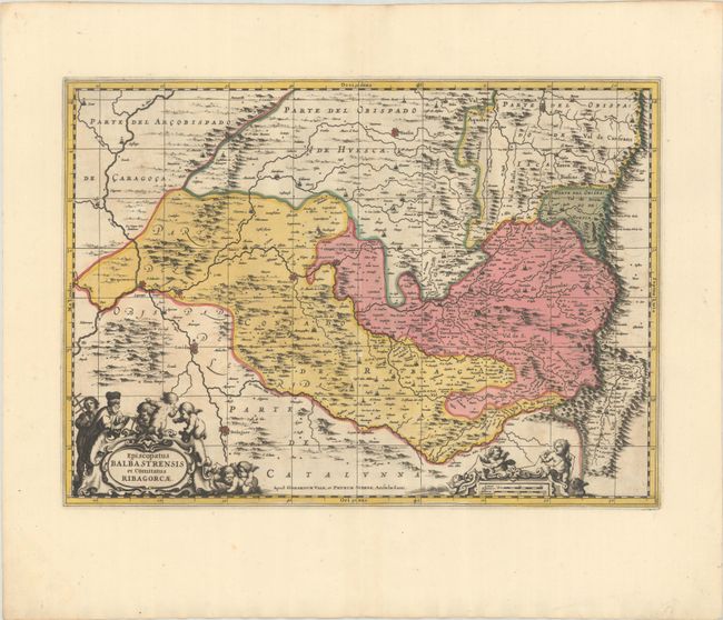
Beautifully decorated map of the region along the border with France, based on the cartography of the Portuguese mapmaker Juan Bautista Labana (1555-1624). Oriented with north to the right, the map is centered approximately on Barbastro and shows the mountainous topography in the region. The map is adorned with two cartouches featuring putti and surveyors. Petrus Schenk acquired the plate from Jansson's heirs and reissued the map with the imprint of his publishing partnership and with the addition of lines of latitude and longitude. Blank verso.
References: cf. Van der Krogt (Vol. I) #6245:1.
Condition: A+
A sharp impression with full contemporary color on a bright sheet with wide margins and a minor crease at bottom right, well away from the image.