Subject: Dunkirk, France
Period: 1694 (circa)
Publication: Les Glorieuses Conquestes de Louis le Grand
Color: Black & White
Size:
21.3 x 17.7 inches
54.1 x 45 cm
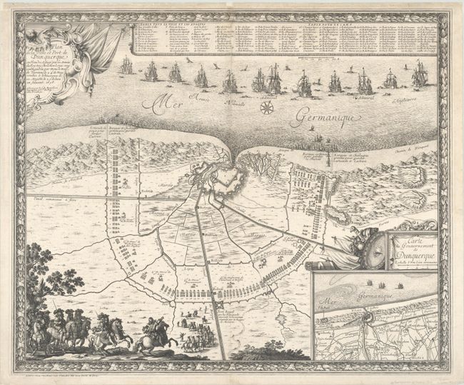
Rare and beautifully engraved plan of Dunkirk by this French military engineer. The large plan shows the 1658 siege and battle of the Dunes in which English and French forces routed the Spanish forces in the dunes near the city and contributed greatly to the surrender of Dunkirk by the Spanish. The English and French encampments surround the city with each infantry company identified in a key at top and the British fleet fills the sea. The Spanish cavalry is graphically shown in the foreground of the map. Large inset plan depicts Dunkirk and the vicinity on a larger scale. The map is richly decorated with cartouches, a compass rose, weaponry, and a frame-style border.
References: Pastoureau, BEAULIEU XV, II [44].
Condition: B+
A sharp impression on a bright sheet with a "P[heart]G" watermark. The centerfold and edges of the sheet have been professionally backed with Japanese tissue to repair a centerfold separation and several small holes along the centerfold, with minor loss of engraved text in the key at top.