Catalog Archive
Auction 197, Lot 493

"Carte de Provence et des Terres Adjacentes", Delisle, Guillaume

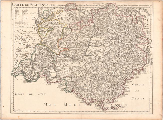
Subject: Southeastern France

Period: 1715 (dated)

Publication:

Color: Hand Color

Size:
23.8 x 18.9 inches
60.5 x 48 cm
Download High Resolution Image
(or just click on image to launch the Zoom viewer)

This splendid map of Provence spans from the Rhone River to Nice and depicts the region in incredible detail. It shows topography, fortified towns, villages, Roman roads, common roads, salt fields, rivers, streams, marshes, bridges, churches, abbeys, castles, and forests. A key at top left identifies the many symbols used on the map and includes two distance scales.

References:

Condition: A

A sharp impression with contemporary outline color on a bright, watermarked sheet. There is soiling along the edges of the sheet, binding holes at far left, and a narrow top margin, as issued. Remnants of hinge tape on verso.

Estimate: $200 - $230

Unsold

Closed on 4/24/2024

Archived