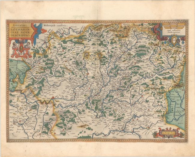
Subject: Northeastern France
Period: 1587 (dated)
Publication: Theatrum Orbis Terrarum
Color: Hand Color
Size:
19.9 x 13.5 inches
50.5 x 34.3 cm
Beautiful map compiled by Ortelius from two maps by Mercator. It is a compilation from "Lotharingiae Ducatus Pars Septentrionalis" and "Lotharingiae Ducatus Pars Medionalis" published in Mercator's atlas Galliae tabulae Geograhicae, 1585. This lovely copper engraved chart includes Metz and Nancy an is filled with hundreds of villages and place names. Adorned with three elaborate cartouches. Latin text on verso, published in 1595.
References: Van den Broecke #50.
Condition: A
A nice impression with full contemporary color on a bright sheet with the crossed arrows watermark commonly found on Ortelius maps. There are a few small abrasions in the image and small remnants of hinge tape on verso.