Catalog Archive
Auction 197, Lot 479

"Flandriae Comitatus Pars Australis, in Castellaniam Insulanam, Balliviatum Duacensem, Territorium Tornacensem, et in Suasquaque Ditiones Subjacentes, Accuratissima Divisa", Visscher, Nicolas

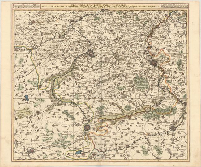
Subject: Northern France & Southern Belgium

Period: 1700 (circa)

Publication:

Color: Hand Color

Size:
21.9 x 19.5 inches
55.6 x 49.5 cm
Download High Resolution Image
(or just click on image to launch the Zoom viewer)

A superbly engraved depiction of southern Flanders along the northern border of France, extending a bit into Belgium. The map is centered approximately on Lille and includes Menen, Tournai, Valenciennes, Douai, Arras and Bailleul. The cities and topography are shown pictorially, a miniature plan representing the fortified cities.

References:

Condition: A

A sharp impression on a bright, watermarked sheet with an archivally repaired centerfold separation at bottom and light, marginal soiling.

Estimate: $160 - $190

Unsold

Closed on 4/24/2024

Archived