Subject: Arctic
Period: 1717 (circa)
Publication:
Color: Hand Color
Size:
22.8 x 13.1 inches
57.9 x 33.3 cm
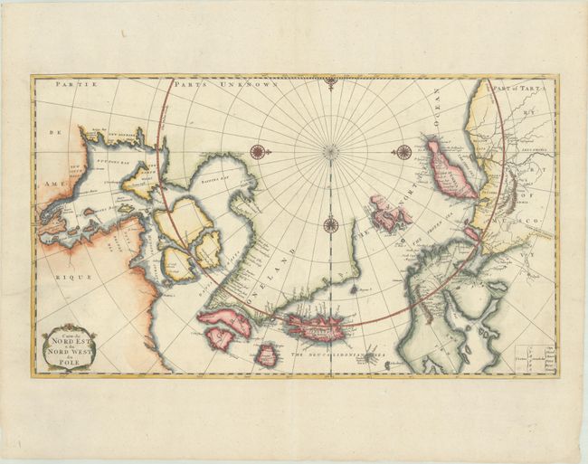
Copper engraved map of the Arctic showing the three-island version of Greenland, and Nova Zembla as an island. The mythical island of Freesland, with several place names, is shown off the southwest coast of Greenland. This map is derived from Moses Pitt's map of the Arctic that was reduced by Robinson in 1694. First published in his Recueil de Voyages au Nord 1717, this example is the second state without a page number. Two place names in Iceland, Papei and Sneland, also suggest a relation with a map by Pierre Duval that accompanied a book about Iceland by La Peyrere, who also wrote a history of Greenland. Embellished with four compass roses and a title cartouche.
References: Kershaw #123.
Condition: A
A crisp impression on a bright sheet that has been trimmed to the neatlines, issued folding and now flattened and mounted on a period-correct folio sheet.