Subject: North Atlantic
Period: 1855 (dated)
Publication:
Color: Black & White
Size:
39.5 x 27.2 inches
100.3 x 69.1 cm
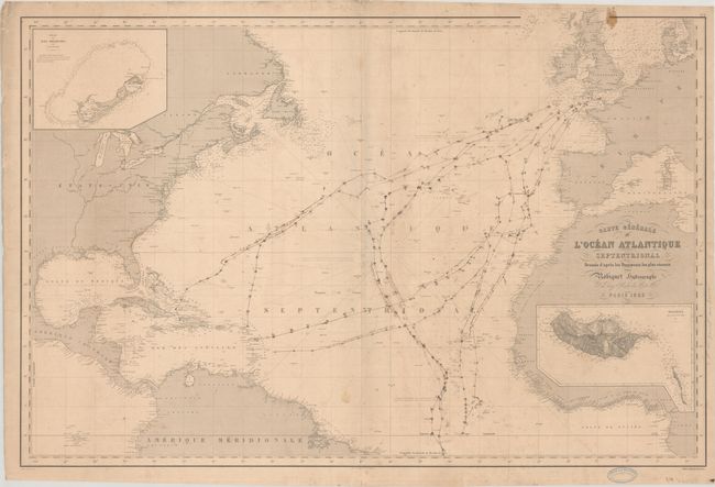
This scarce French sea chart covers the North Atlantic. There is plenty of useful navigational information, including soundings and notes on the winds. Place names line the coasts, but the inland areas are mostly blank, although major rivers are delineated in the United States and Canada. It extends to show the Galapagos, the North Sea, and islands in the Mediterranean. The inset of Bermuda at top left is based on the hydrographic survey begun by Thomas Hurd in 1789, the first complete scientific survey of the island. Another inset at bottom right shows Madeira as surveyed by Alexander Thomas Emeric Vidal. Engraved by Leclerq. Includes the stamps of "Libraire de A. de la Porte" and "Robiquet Libraire de la Marine" in the lower margin. Price of "Quatre Francs" appears below the neatline at bottom right.
References:
Condition: B
On a lightly toned and foxed sheet with a stain at top right, light soiling and creasing, and manuscript notations in brown ink tracing routes through the ocean. There is a 0.5" tear along the border at right and some edge tears, including one that enters 1.25" into map image at lower right. The map was stored rolled and does not lay flat on its own.