Subject: North Atlantic
Period: 1837 (dated)
Publication:
Color: Black & White
Size:
43.9 x 39 inches
111.5 x 99.1 cm
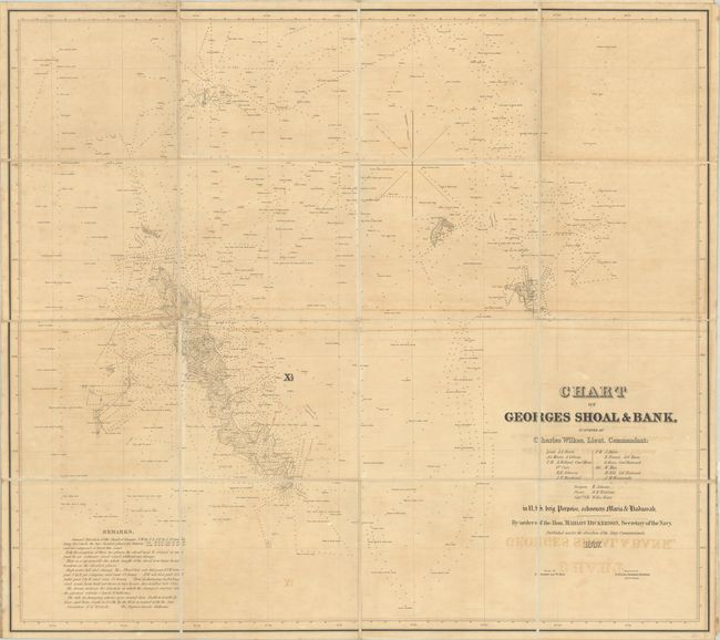
This is one of only two charts produced by Charles Wilkes prior to leading the United States Exploring Expedition from 1838-1842.
Rumors of Europeans finding fertile fishing grounds in the northwestern Atlantic circulated for 500 years prior to John Cabot’s discovery of Newfoundland in 1497. In the early 16th century, Giovanni da Verrazano specifically discovered Georges Bank, naming it Armelline Shoals. In 1605 English colonists renamed it St. George, and developed it into a very important fishing ground. As such, there were many charts devoted to the area, but none with as much detail as Wilkes' chart. There are over 1,000 soundings with very detailed descriptions of the ocean floor. There are also remarks at lower-left that point out shallow areas and tidal information. Wilkes’ survey of these waters was so complete, that it was 100 years before another government survey was ordered. Dissected into 16 sections and backed with linen, as issued. A scarce map that we have sold only one other time.
References:
Condition: B
On a lightly toned sheet with some scattered foxing and offsetting. Dissected and backed with linen.