Subject: Bermuda
Period: 1642 (circa)
Publication:
Color: Hand Color
Size:
21 x 15.9 inches
53.3 x 40.4 cm
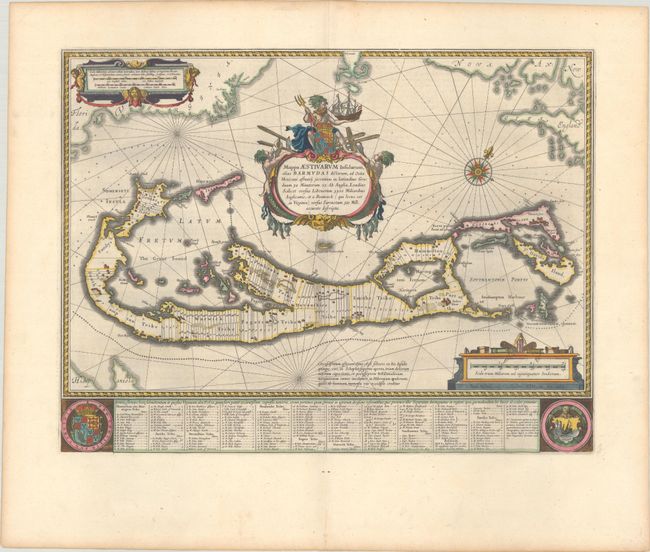
This magnificent map is based on the famous survey by John Norwood of the Bermuda Company, also known as the Somers Isles Company, in 1618. The map shows the division into the original Tribes, a short-lived term for the major shareholders in the company, that became administrative parishes. Also shown are the various landowners, with their names in a table below the map. There are many tiny houses shown on the map, locating settlements, as well as minute cannons marking the defensible points. The beautiful title cartouche features Neptune astride the Royal Arms, holding a fine ship. Further adorned with scale cartouches, coats of arms and a compass rose. The map uses a unique device to show Bermuda's correct proportion and position in the North Atlantic by superimposing this map over a smaller scale map of the Atlantic with the coastlines of Britain, North America and Hispanola, with a tiny island of Bermuda appearing just beneath the title cartouche. Dutch text on verso, published between 1642-64 in either Toonneel des Aerdrycks or Grooten Atlas.
References: Goss (Blaeu) p. 166; Palmer (MCC-19) #7; Van der Krogt (Vol. II) #9660:2.
Condition: A+
A sharp impression with full contemporary color. Fine.