Subject: Atlantic Ocean
Period: 1780 (circa)
Publication: Atlas Geographique
Color: Hand Color
Size:
25.1 x 19.1 inches
63.8 x 48.5 cm
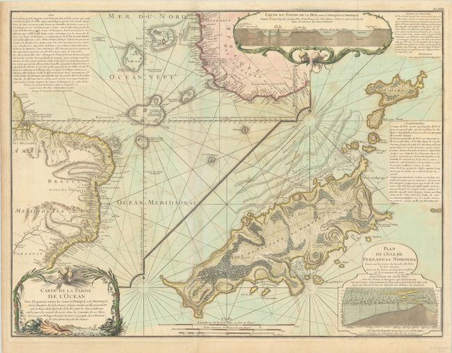
An important early geological map in two sections. The left side is a chart of the Atlantic Ocean with detailed coastlines of Africa and Brazil with the islands in between. The right side features a detailed chart of the Island Fernand de Noronha off the coast of Brazil. This map was issued in a series drawn by Philippe Buache to illustrate his theory of the continuity of mountain chains under the sea. At top is a cut-away plan, enclosed in a cartouche, showing these mountain ranges between the two continents. Another similar plan is incorporated into the cartouche for the Plan of Fernand de Noronha. Several blocks of text explain Buache's theory. Imprint of Dezauche, who succeeded Buache in about 1780.
References:
Condition: B
A nice impression, issued folding with contemporary color in the map and later color in the cartouches, on a sheet with the watermark of a Maltese cross encircled in rosary beads. There is moderate toning and foxing.