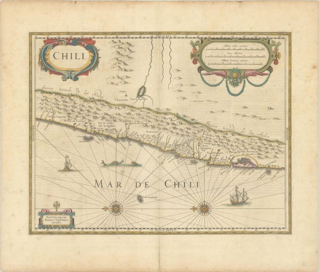
Subject: Chile
Period: 1645 (circa)
Publication: Nieuwen Atlas, oste Werelt-Beschrijvinge...
Color: Hand Color
Size:
19.1 x 14.7 inches
48.5 x 37.3 cm
Striking map covering the known coastal region of Chile from approximately Antofagasta in the north to Cabo Gallegos in the south. The Andes are shown prominently, with two live volcanoes in the vicinity of Villarrica. Beyond the mountains, in what is now Argentina, is a large unnamed (and nonexistent) lake with the cities of Mendoza and San Juan - with San Juan incorrectly placed to the south of Mendoza. Otherwise, the map is surprisingly accurate for its age with many recognizable place names: La Serena, S. Iago (Santiago), Concepcion, Valdivia, and the Gulf of Ancud are all located. Decorated with two large cartouches, two compass roses, ships, and sea monsters. North is oriented to the left. At lower left is Jansson's imprint (replacing the earlier Hondius imprint) in a small cartouche. Dutch text on verso, published 1645-58.
References: Van der Krogt (Vol. I) #9920:1:2.
Condition: B+
A nice impression with full contemporary color. There is light foxing, a tiny wormhole in map image, and a centerfold separation in the bottom blank margin that has been repaired on verso with archival materials. A few edge tears and pairs of short worm tracks appear in the bottom margin as well.