Subject: Grenada
Period: 1779 (dated)
Publication:
Color: Hand Color
Size:
23.3 x 17.2 inches
59.2 x 43.7 cm
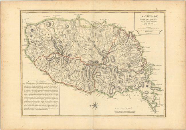
This is Lattre's scarce and handsome French map of Grenada, based on Thomas Jefferys' map of the island, first published in 1775. It features incredible detail, depicting the topography by use of hachure along with roads, towns, hospitals, and plantations. The coastlines are well delineated and include the locations of safe harbor and soundings in the bays. A description at bottom left describes the attributes of the land and notes the fifty paces along the coast belonging to the King of England. Grenada had passed back and forth between the British and French colonial powers during the 18th century, with France ceding the island to Britain in the 1763 Treaty of Paris. The French regained control during the American battle for independence, and won the island during the 1779 Battle of Grenada. In 1783, the island was ceded back to the British with the Treaty of Versailles. The composition is completed by a striking compass rose at bottom that orients the north to the left.
References: Tooley (MCC-62) Grenada #31.
Condition: B+
A nice impression with contemporary outline color on a sheet with the watermark of a Maltese cross encircled by rosary beads. There is light foxing, much of it in the margins, and minor soiling.