Subject: North America
Period: 1790 (circa)
Publication:
Color: Black & White
Size:
17.1 x 10.5 inches
43.4 x 26.7 cm
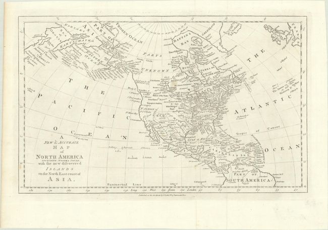
This map of North America focuses on the discoveries of Captain Cook in the Pacific Northwest and Alaska. Alaska is fairly well formed, although much of the Aleutian Island chain is depicted as a peninsula. Northern Canada is marked Parts Unknown, and northern California is New Albion. The northeast coast of Asia is depicted with a well-formed Kamtschatka Peninsula. New Mexico encompasses present-day Louisiana and Texas, while the southeastern seaboard states all extend to the Mississippi River. On the continent, political divisions are delineated by dotted lines, and numerous Indian nations are located. Although there is no engraver signature, this map is identical to one engraved by Thomas Bowen for Bankes's New System of Geography.
References:
Condition: A
Issued folding on a clean bright sheet with a lily watermark. There is a faint spot at center and a small paper flaw along the bottom border.