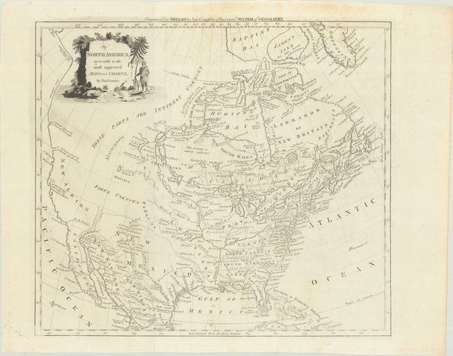
Subject: Colonial North America
Period: 1780 (circa)
Publication: Millar's New Complete & Universal System of Geography
Color: Black & White
Size:
14.8 x 13.1 inches
37.6 x 33.3 cm
This Revolutionary War era map shows early colonial boundaries and much interesting cartography. The Carolinas, Virginia, and West Florida all extend to the Mississippi River. The Red River of the North, R. Rouge, is shown correctly flowing from Lake Winnipeg, but connected a little too directly to the Mississippi River. The western part of the continent is described as both Parts Unknown and Intirely Unknown. The West Coast shows the straits of both Juan de Fuca and Martin Aguilar, in addition to the port of San Francisco, noting that Sir Francis Drake spent five weeks there. The interest in a Northwest Passage via Hudson Bay is evident by the notes surrounding the region, including an assertion that "If a West Passage exists it must be thro one of these Bays." An uncommon map.
References:
Condition: B+
Issued folding with some very faint offsetting and a bit of foxing that is mostly in the top blank margin.