Subject: Western Hemisphere - America
Period: 1790 (circa)
Publication:
Color: Hand Color
Size:
22.8 x 17.8 inches
57.9 x 45.2 cm
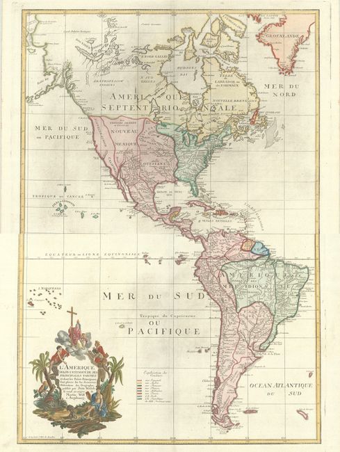
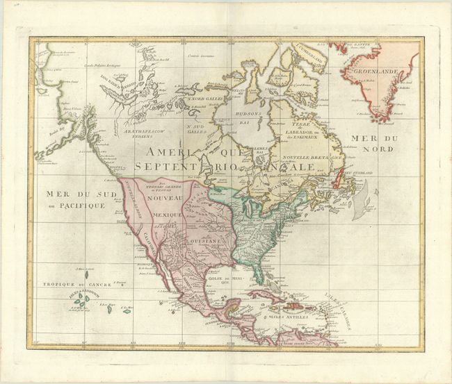
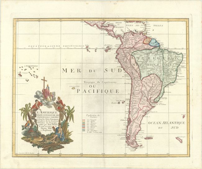
A very uncommon map of the Americas on two separate sheets, made in Germany for the French market and sold by Martin Will. In North America, the young United States, labeled Republique des XIII Provinces Unies, incorporates the upper Midwest with its boundary along the Mississippi River. Spain controls the remaining western territories of Louisiana, Nouveau Mexique, Nouvelle Albion and Californie. Florida is incorrectly colored as part of the United States. The explorations of Captain Cook are evident in Alaska, which appears in a very unusual tadpole shape. Spain controls vast regions of South America with smaller regions shown to be the possessions of Portugal (Brazil), France (Guyana), and Holland (Suriname). A colored key is included in the south Pacific. The elaborate cartouche refers to the conversion of Native Americans to Christianity, with natives bowing to a figure holding a cross and chalice while an Amazon queen reclines in the foreground surrounded by an alligator, a parrot and a monkey.
References:
Condition: A
Dark impressions on bright sheets with a "CS" watermark, light printer's ink residue, and several printer's creases in Canada. A couple of cracks in the plate are also visible in central Canada. The first image is a composite image - the map is in two separate sheets.