Subject: Exploration & Surveys
Period: 1854 (published)
Publication: H.R. Doc. 12, 33rd Congress, 1st Session
Color: Black & White
Size:
9 x 11.6 inches
22.9 x 29.5 cm
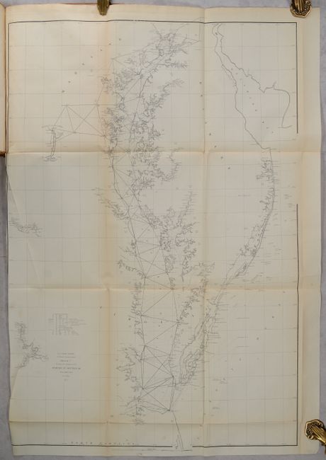
The Office of Coast Survey is the oldest U.S. scientific organization, dating from 1807 when Congress directed that a "survey of the coast" be carried out. By 1836, it was called the U.S. Coast Survey and in 1878, the name was changed to the U.S. Coast and Geodetic Survey. Today the Office of Coast Survey is a division of the National Oceanic and Atmospheric Administration NOAA.
The survey teams, composed of civilians as well as Army and Naval officers, charted the nation's waterways and produced a wide array of reports, survey charts, hydrographic studies of tides and currents, astronomical studies and observations, and coastal pilots. These charts are an important record of the changing nature of the nation's coastlines. In additional to coastal charts, the U.S. Coast and Geodetic Survey produced land sketches, Civil War battle maps, and the early aeronautical charts.
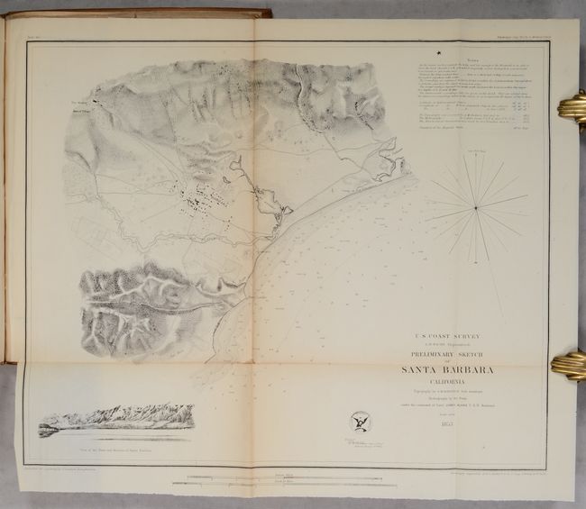
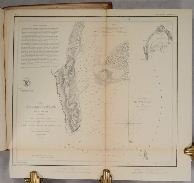
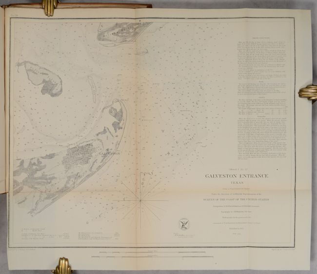
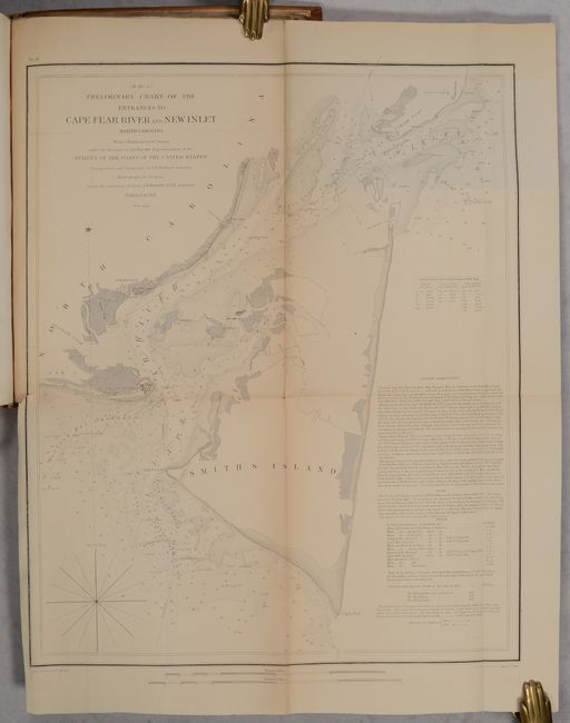
This annual report by the Coast Survey is complete and contains fifty-four folding charts and sketches. The surveys covered by this report include the Atlantic, Gulf and California coasts. Important charts include Seacoast of Virginia, Cape Fear River, Galveston Entrance, San Diego Entrance, Santa Barbara, and San Francisco Bay and Vicinity (see images for a complete listing of charts). 186 pages. Printed in Washington D.C. by Robert Armstrong. Hardbound in full contemporary leather with gilt title labels on spine.
References:
Condition:
The folding maps range from good (B) to near fine (A) with occasional light toning, minor foxing, a few fold separations, and short binding tears. Text is good with some light toning and occasional foxing. Covers are bowed, worn and have minor stains. Maps: B+ (on average) / Binding - B