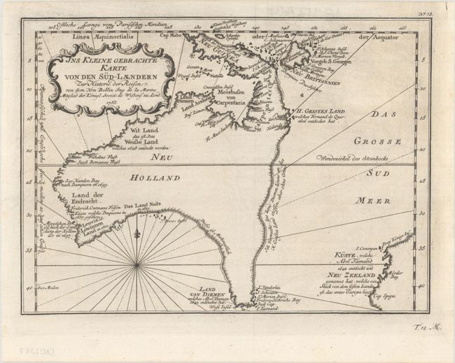
Subject: Australia
Period: 1753 (dated)
Publication: Allgemeine Historie der Reisen zu Wasser und Lande…
Color: Black & White
Size:
10.8 x 7.8 inches
27.4 x 19.8 cm
This scarce German edition map is one of the few 18th century maps to focus on the Australian continent prior to Cook's famous first voyage from 1768-1771. Mainland Australia is connected to both Tasmania (Terre de Van Diemen) and Papua New Guinea (Nouv. Guinee). Along the imaginary eastern coastline is a note that reads: "I suppose that the land of Diemen can join with the land of the Holy Ghost, but this is without proof." A partial coastline of New Zealand is shown peeking out of the corner of the map, with a note that it was discovered by Abel Tasmand in 1642 and speculation that it might be part of a great southern continent. This is an important map of Australia depicting the interesting theories made prior to exploration of the region later in the century.
References: cf. Tooley (Australia) p. 24, #156; cf. Tooley (MCC-23) #80.
Condition: A+
A crisp impression on a clean bright sheet.