Subject: Solomon Islands
Period: 1787 (circa)
Publication: Atlas Encyclopedique
Color: Hand Color
Size:
13.6 x 9.3 inches
34.5 x 23.6 cm
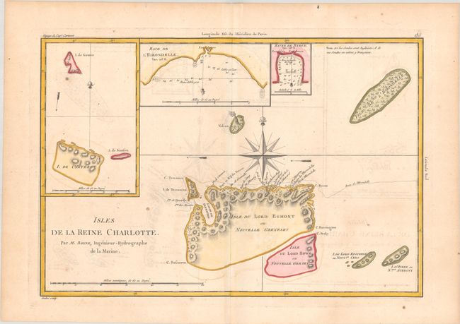
This lovely chart, based on Cook's voyages, shows the Santa Cruz Islands, part of the extensive Solomon Islands east of Papua New Guinea. Isle du Lord Egmont ou Nouvelle Grenesey and Isle du Lord Howe ou Nouvelle Gersey have been only partially engraved to show the explored portions. At that time the group shown on the map was named for Queen Charlotte, wife of King George III. (The map is sometimes mistaken for the Queen Charlotte Islands or Haida Gwaii along the north Pacific coast of Canada.) Insets of Carteret Island, Baye de l'Hirondelle, and Havre de Byron complete the composition. Main chart centered on a decorative compass rose, with a small volcano just west of it. Engraved by Andre.
References:
Condition: B+
A crisp impression on watermarked paper with light dampstaining, minor offsetting, and a few small spots.