Subject: Africa
Period: 1680 (circa)
Publication:
Color: Hand Color
Size:
22.9 x 19.4 inches
58.2 x 49.3 cm
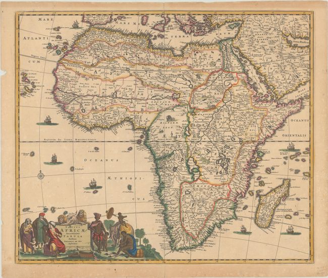
The information contained in this beautiful map of the African continent is typical of the late 17th century. The Nile appears according to the ancient pattern of Ptolemy, arising from the two lakes of Zaire and Zafflan. De Wit's depiction of the southeastern coast includes numerous deep inlets and several rivers and lakes at the southern tip not seen on other maps of the period. The kingdom of Monomotapa extends as far south as the Rio de Infante and there are few names in the interior of the Cape. The fictitious N. I. De Sta. Helena appears in the South Atlantic. The interior is decorated with elephants, ostriches, monkeys, lions, and rhinoceros, and seven small ships sail in the oceans. The well-engraved title cartouche features Moors and Africans with a child seated on an elephant and two lions perched atop the title. This map was copied by several other cartographers including Danckerts and De Ram. This is the third state according to Betz or the fourth state according to Carhart, with the number 3 engraved in the border at top right and the longitudinal gridlines at top and bottom beginning with 348 - 358.
References: Betz #114.3; Carhart #8.4; Norwich #48.
Condition: B+
A crisp impression with full contemporary color on a lightly toned sheet with short centerfold separations at top and bottom and a small chip in left margin well away from image.