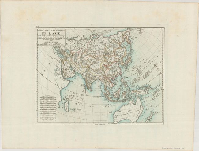
Subject: Asia
Period: 1798 (circa)
Publication: Atlas National
Color: Hand Color
Size:
16.8 x 12.7 inches
42.7 x 32.3 cm
A finely engraved chart that extends from Madagascar across the breadth of Asia to the Pacific to include Australia, New Zealand, the East Indies, the Philippines, Japan, China, Indo-China, Russia and the Middle East. Tasmania is mostly off the map, but made to appear attached to Australia. The title is contained in a rectangular cartouche with "An VI" which translates from the French as "Year 6" of the Revolutionary calendar, 1798. At lower left are a remarkable number of distance scales, twelve in all. No engraver is credited, yet it was likely Tardieu .
References:
Condition: A
A crisp impression a watermarked sheet with wide margins. There is some minor foxing confined to the top blank margin.