Subject: Lebanon
Period: 1955 (dated)
Publication:
Color: Printed Color
Size:
26.6 x 36.5 inches
67.6 x 92.7 cm
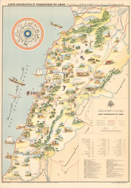
This decorative tourist map of Lebanon was drawn by Paul Koroleff and features text in French, Arabic, and English. The map is profusely illustrated to show cultural sites, recreational activities (even skiing), natural attractions, agriculture, and more. The road network is identified in red overprinting along with only two railroads in black. An alphabetical listing of points of interest are displayed at bottom right; on this edition, the sites are listed in Arabic and English. The map is adorned by an elaborate sundial, various ships in the Mediterranean, and an airplane approaching Beirut.
References:
Condition: A
Clean and colorful on a sheet with a "Navarre Voiron" watermark.