Catalog Archive
Auction 196, Lot 568

One of the Most Decorative 17th Century Maps of Malta in Full Contemporary Color

"Insula Malta Accuratissime Delineata, Urbibus, et Fortalitiis", Wit, Frederick de
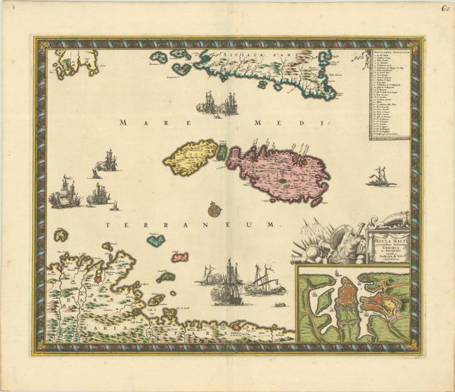
Subject: Malta

Period: 1690 (circa)

Publication:

Color: Hand Color

Size:
21.3 x 17.4 inches
54.1 x 44.2 cm
Download High Resolution Image
(or just click on image to launch the Zoom viewer)

This superb map shows the strategic location of Malta between Sicily and the northern coast of Africa where the fortified cities of Tunis and Tripoli are highlighted. A large inset shows the extensive fortifications of Valleta that were built by the famous Knights of Malta after the Siege of Malta. Three sea battles are depicted in the Mediterranean and a key identifies the important sites. The title cartouche is festooned with implements of war and a beautiful, picture-frame style border encloses the map. This is the second state, with "25" added at top right.

References: Carhart (De Wit) #46.2.

Condition: A+

A sharp impression with superb, full contemporary color on a bright sheet with a "P" watermark from Pieter van der Ley. There is minor soiling above the ships at bottom center.

Estimate: $1,000 - $1,300

Sold for: $750

Closed on 2/7/2024

Archived