Subject: North Pole, World War II
Period: 1943 (published)
Publication:
Color: Printed Color
Size:
18.5 x 15 inches
47 x 38.1 cm
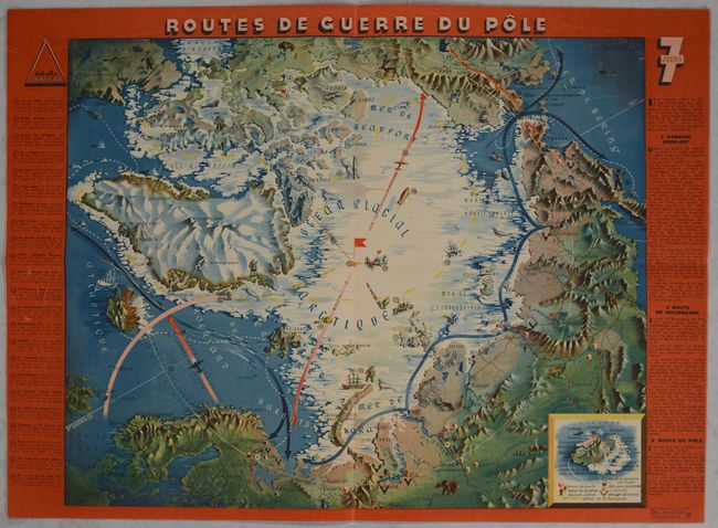
This unusual World War II-era map centers on the North Pole and depicts three routes by which the Soviets could communicate with their American allies. As described in French text at right, the three routes are the secret Northwest Passage, the route from Boston to Murmansk via ship, and the flying route over the North Pole - an impossibility during the dangerous winter months. A legend at bottom right uses a composite map to identify the types of topography on the main map; it also locates coal mines, mineral holdings, sawmills, reindeer herding, ice floe drifts, and more. A numbered key at left provides further information for 23 locations on the map. The map was designed by graphic artist Jacques Mercier for the January 10, 1943 edition of 7 Jours. The entire issue of the magazine is included here, with Maria Denis, a popular Italian film star during its fascist period, on the cover.
References: Rumsey #15801.
Condition: A
Map is near fine with a horizontal fold by a previous owner.