Subject: Eastern Europe, Poland
Period: 1714 (circa)
Publication:
Color: Hand Color
Size:
21.4 x 18.9 inches
54.4 x 48 cm
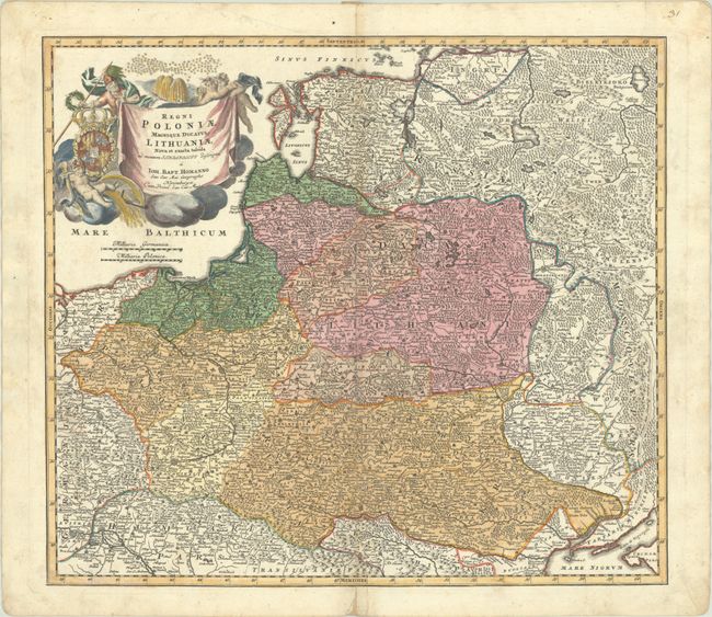
Homann's striking map covers Poland, Lithuania, Latvia, Estonia, and a portion of Russia, extending from St. Petersburg in the north to the Black Sea in the south. The map includes a lot of topographic detail and as well as the cities of Kiev, Minsk, Warsaw, and Vienna. A gorgeous allegorical cartouche fills the Baltic Sea and features Ares, god of war, holding both a spear and a laurel wreath; the Polish-Lithuanian coat of arms under Wettin dynasty; and beehives symbolizing industry.
References:
Condition: B+
A nice impression with contemporary color in the map and later color in the cartouche, on a bright sheet with a coat of arms watermark. There is light toning along the centerfold, several small worm holes, marginal soiling, and a repaired centerfold separation at bottom.