Subject: North Pole
Period: 1644 (circa)
Publication:
Color: Hand Color
Size:
20.9 x 16.2 inches
53.1 x 41.1 cm
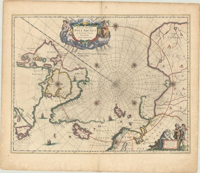
This beautiful map, originally published in 1637, eventually replaced Hondius' map of the North Pole and became the prototype for many later maps including those of Blaeu. This map incorporates the discoveries made by Captain Thomas James along the southern and western shores of Hudson Bay in 1631-2. The delineation on Russia's Arctic coast is derived from the information from Willem Barents' exploration of 1596-7. A small island off the coast of Lapland is named for the English explorer Hugh Willoughby (Sr. Hugo Willoughby's Landt), who led a failed expedition to find a Northeast Passage in 1553. Rhumb lines radiate from the North Pole, and several compass roses embellish the chart. A large title cartouche, with two figures and numerous wind heads, conveniently hides the northwest coast of America. The map is further decorated with ships and a cartouche with Jansson’s imprint, which depicts men in parkas, a polar bear, and foxes. This is the first state of the map without a legend beneath the cartouche. German text on verso.
References: Burden #250; Kershaw #108; Van der Krogt (Vol. I) #0020:1C .
Condition: B+
Full contemporary color with minor toning and a few spots of foxing. There is a centerfold separation that extends 6.5" into the image at bottom that has been archivally repaired on verso.