Catalog Archive
Auction 196, Lot 506

"[Lot of 2] Parte Orientale del Regno di Boemia di Nuova Projezione [and] Parte Occidentale del Regno di Boemia di Nuova Projezione", Zatta, Antonio

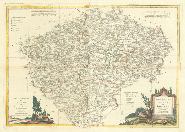
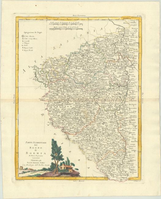
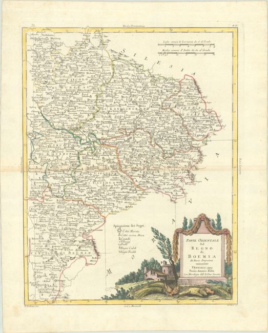
Subject: Czech Republic

Period: 1779-80 (dated)

Publication: Atlante Novissimo

Color: Hand Color

Size:
12.3 x 16.2 inches
31.2 x 41.1 cm
Download High Resolution Image
(or just click on image to launch the Zoom viewer)

This lovely two-sheet map covers all of Bohemia with the region divided into circolos (okres). A small portion of the middle section of Bohemia is duplicated on each sheet, so that Prague is shown on both sheets. A key identifies cities (both walled and without walls), castles, villages, postal stops, and hot and cold baths. Each sheet stands on its own with full borders and a decorative title cartouche depicting a rural scene. Drawn by G. Zuliani and engraved by G. Pitteri.

References: Shirley (BL Atlases) T.ZAT-1a, Vol. 2 #5 & #6.

Condition: A

Crisp impressions with full contemporary color on bright sheets with the watermark of three crescent moons and minor toning along the centerfolds. The first image is a composite image - the map is in two separate sheets.

Estimate: $240 - $300

Unsold

Closed on 2/7/2024

Archived