Subject: Southwestern Poland
Period: 1758 (dated)
Publication:
Color: Hand Color
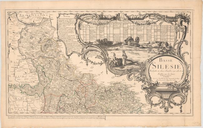
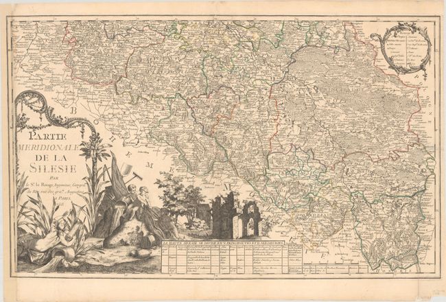
This large 2-sheet map of the historical region of Silesia is a reduced edition of a 16-sheet map of the region, with the cartography credited to Johann Wolfgang Wieland and Matthäus Schubarth. The map extends from Frankfurt an der Oder in the northwest to Frydek-Mistek in the southeast, with Wroclaw (Breslau) approximately in the center. There is intricate detail of tiny towns and fortified cities, roads, political boundaries, churches, convents, castles, and the topography of the land, with a legend on the southern sheet. Both sheets include tables listing the political divisions in the region, as well as superb cartouches with large vignettes engraved by Martinet. The northern sheet features a lovely scene of the countryside, while the southern sheet includes a river god, cherubs with fishing and hunting gear, and ruins. Le Rouge includes a note below the northern sheet explaining that his map corrects numerous errors from previous maps, and that the public should notice the great difference between maps engraved by "second-hand dealers" compared with "geographers" (such as himself).
A. Basse Silesie Reduitte en Deux Feuilles sur Celle de 16 Faittes sur les Lieux, (29.4 x 16.9").
B. Partie Meridionale de la Silesie, (28.8 x 17.6").
References:
Condition: B+
Nice impressions with contemporary outline color on sheets with large watermarks of a Maltese cross encircled in rosary beads. Both sheets have a small repaired hole at bottom right, with minute loss of image. The southern sheet has been remargined at left with the border replaced in facsimile.