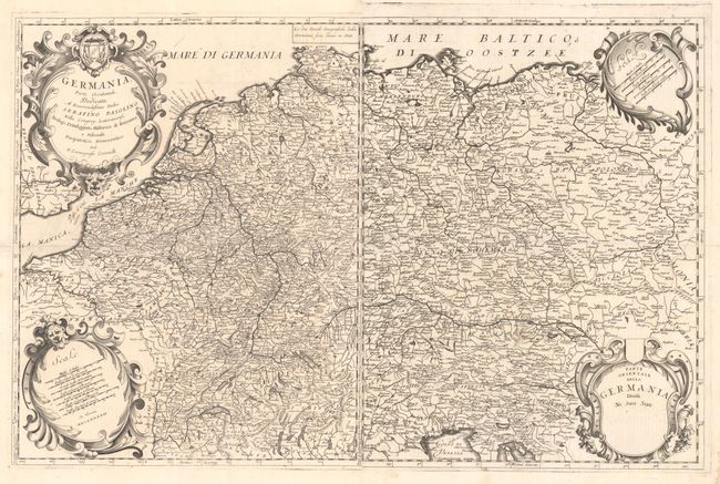
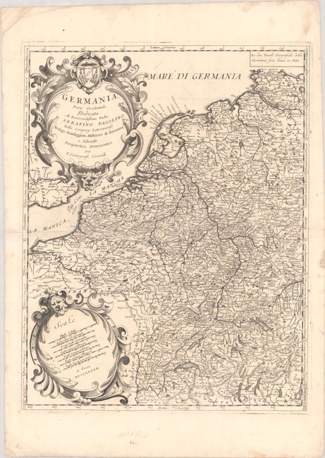
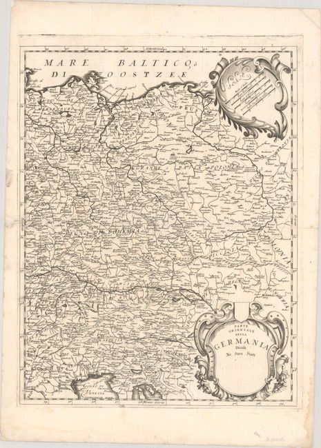
Subject: Central Europe, Germany
Period: 1692 (dated)
Publication: Isolario
Color: Black & White
Size:
17.6 x 22.7 inches
44.7 x 57.7 cm
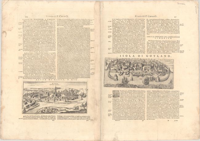
This beautifully engraved two-sheet map spans from the mouth of the Seine east to the Vistula and from the German-Danish border south to Gulf of Venice. It extends across the Passo di Cales Ouero (Strait of Dover) to show a portion of the English coast. The map is dense with place names, including the state names of the Holy Roman Empire. Both sheets feature their own separate borders and ornate strapwork distance scale and title cartouches. The verso of the western sheet features bird's-eye views of Kiel (9.2 x 4.5") and Visbla (Visby) on the island of Gotland (9.9 x 4.3"). Italian text on verso. Coronelli (1650 - 1718) was a Franciscan friar who established the society of geographers "Accademia degli Argonauta," one of the oldest in the world, and became the official geographer of the Venetian Republic. His maps are distinguished by his elegant engraving style and cartographic rigor.
References: Shirley (BL Atlases) T.CORO-13a #149-152.
Condition: A
Bright sheets with sharp impressions. The eastern sheet has short centerfold separations that enter 1.5" into the map image at left and right which have been closed on verso with archival materials. There is light soiling and dampstaining confined to the blank margins. The first image is a composite image - the map is in two separate sheets.