Subject: Paris, France
Period: 1756 (dated)
Publication:
Color: Hand Color
Size:
30 x 23.7 inches
76.2 x 60.2 cm
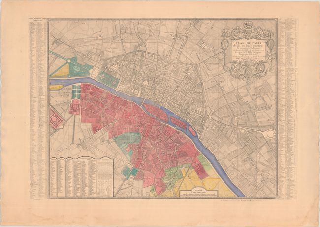
This large, striking bird's-eye plan of Paris is divided into the sixteen districts that were established in 1684. The title cartouche is surrounded by coats of arms of the members of the Bureau de la Ville (city government) and Jean-Baptiste Taitbout, the clerk of the court. Tables along both sides and at bottom indicate the locations of roads, churches, schools, and hospitals. The map is beautifully detailed with depictions of gardens, windmills, fields, and boats along the river Seine. Designed by Lange, engraved by Marvyc. Published by Hugnin. This edition is updated to 1756.
References:
Condition: B+
A fine impression on a sheet with wide margins and light toning. There is an edge tear that enters 1" into the index at right that has been partially closed on verso with archival tissue, and light dampstaining that is confined to the bottom blank margin.