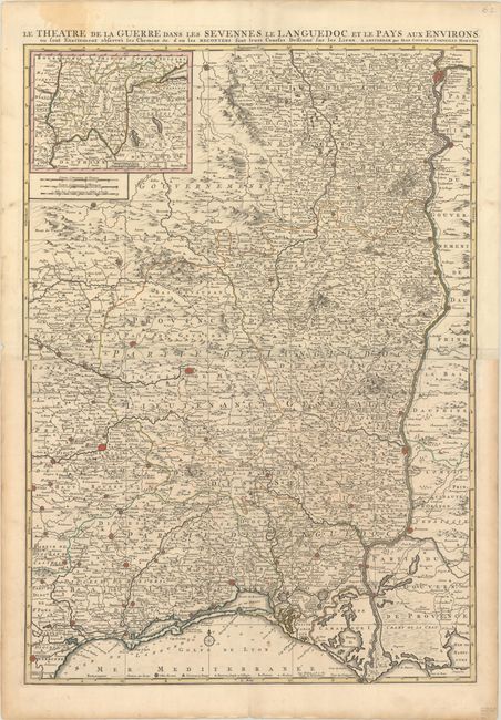
Subject: Southern France
Period: 1722 (circa)
Publication:
Color: Hand Color
Size:
23.2 x 33 inches
58.9 x 83.8 cm
This map focuses on the War of the Camisards in Cévennes and Languedoc during the reign of Louis XIV. The Camisards were Protestant peasants, who began an uprising after their religion was banned by the Louis XIV in the edict of Fontainebleau. The map extends from Lyons and Thiers in the north to Arles and Narbonne in the south. The map is filled with hundreds of tiny towns, the larger of which are shown as miniature fortified cities, as well as roads, political boundaries, rivers, and mountains. An inset map at top left extends the map further north to Geneva and Macon. This is the second state, with both Covens & Mortier's name in the imprint. Printed on two sheets, joined as issued.
References: Van Egmond (Covens & Mortier) #21.2.
Condition: A
A nice impression with contemporary outline color, issued folding with a small paper flaw in the image, marginal toning and dampstaining, and short fold separations in the top and bottom blank margins.