Subject: France
Period: 1593 (published)
Publication: Speculum Orbis Terrae
Color: Hand Color
Size:
17.8 x 12.1 inches
45.2 x 30.7 cm
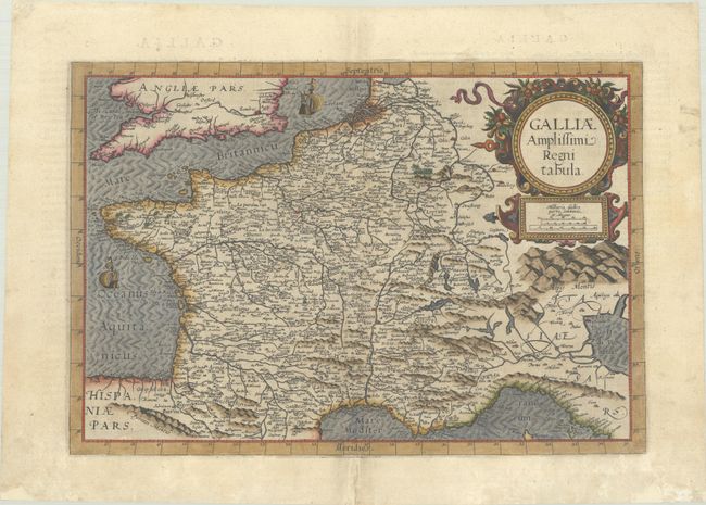
This rare map of France appeared only in the second edition of the Speculum Orbis Terrae. The map focuses on France but covers a wider region including southern England, Holland as far north as Amsterdam, Switzerland and northern Italy. The large strapwork title cartouche is adorned with fruit and ribbons, and two sailing ships decorate the oceans. Latin text on verso.
Cornelis de Jode (1568-1600) was the son of the mapmaker and publisher Gerard de Jode. The elder published several important maps, including Ortelius' famous 8-sheet map of the world in 1564. His major atlas, Speculum Orbis Terrarum was a commercial failure because his rival, Abraham Ortelius, was able to obtain a monopoly for eight years at the same time De Jode was preparing the publication. After Gerard's death, his widow and son enlarged the atlas and re-issued it in 1593. On the death of Cornelis, the copper plates were sold to J. B. Vrients, who acquired them merely to stop their re-issue, as he had also acquired the Ortelius plates. De Jode maps are rarely offered on the market. While the atlas did not have much commercial success, de Jode's maps are often regarded as superior in both design and cartographic detail to his more successful competitor, Abraham Ortelius.
References: Van der Krogt (Vol. III) #4000:32B.
Condition: A
A sharp impression on a watermarked sheet with marginal soiling and professional repairs to several short separations along the centerfold and to 3 chips in the bottom margin, well away from the image.