Subject: North Sea & Britain
Period: 1671 (circa)
Publication:
Color: Hand Color
Size:
22.5 x 19.5 inches
57.2 x 49.5 cm
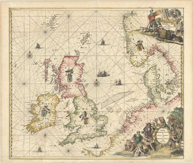
This beautiful sea chart of the North Sea includes the British Isles, the Faroe Islands, and the stretch of coastline extending from Norway south to Normandy. It includes two compass roses and is crisscrossed by rhumb lines. The seas are filled with sailing ships and a naval battle, and putti hold aloft the coats of arms of Ireland, Scotland, England, and Norway. Soundings appear throughout. There is a Dutch title cartouche at top right that features Athena with a fox and a bear and a logging scene. An additional Latin title cartouche at bottom right shows various allegorical figures including Neptune, Urania, and the States Lion with his sword and arrows. First state, without sea names, published 1671-76.
References: Carhart #C9.1; Shirley (BI to 1750) De Wit 4.
Condition: A
A sharp impression on a bright sheet with one tiny hole west of Norway caused by a paper flaw, a few very minor spots, and professional repairs to centerfold separations at top and bottom.