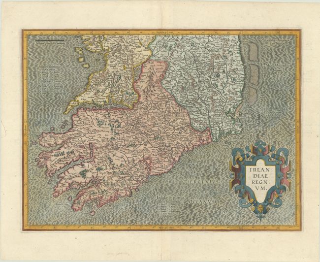
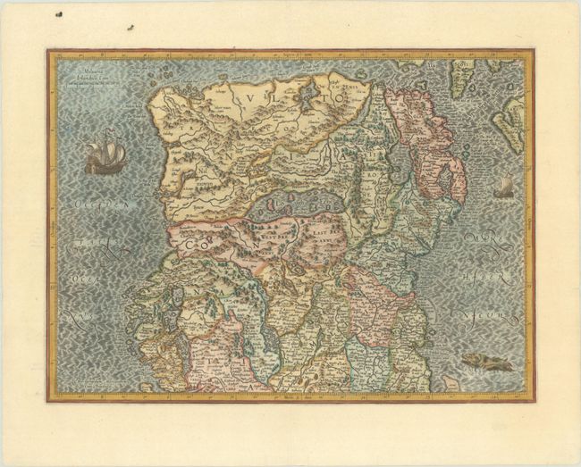
Subject: Ireland
Period: 1613 (circa)
Publication: Gerardi Mercatoris - Atlas sive Cosmographicae…
Color: Hand Color
Size:
18.6 x 13.4 inches
47.2 x 34 cm
Superb early pair of maps covering the whole of Ireland compiled from his landmark map of Britain (1564). These two maps were among five Irish maps Mercator designed for the second part of his Atlas. The maps are richly engraved with a moiré pattern in the seas and strong topographical features in the interior. The northern section is decorated with sailing ships and a sea monster and there is no title cartouche - only Mercator's imprint. The southern sheet features the bold, strapwork title cartouche. Size is for each map. Latin text on verso, published between 1613-30.
References: Law, pp. 19-20; Van der Krogt (Vol. I) #5901:1.1 & #5902:1.1.
Condition: A
Sharp impressions on bright sheets with an archivally repaired edge tear on the southern sheet and minor marginal soiling on the northern sheet. Margins of the southern sheet have been slightly trimmed, but are still very ample.