Catalog Archive
Auction 196, Lot 401

"A New Description of the Shyres Lothian and Linlitquo. Be T. Pont", Hondius, Henricus

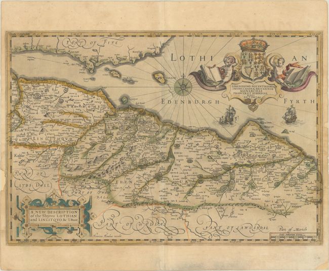
Subject: Southeastern Scotland

Period: 1638 (published)

Publication: Atlas Novus

Color: Hand Color

Size:
21.3 x 14.4 inches
54.1 x 36.6 cm
Download High Resolution Image
(or just click on image to launch the Zoom viewer)

This map is based on the surveys of Timothy Pont, who is credited within the title. The map focuses on Lothian, with Edinburgh at the center. The map gives good detail of towns, roads, rivers, and mountains in the area. A superb cartouche in the Firth of Forth dedicates the map to King James I. Latin text on verso.

References: Van der Krogt (Vol. I) #5815:1.2.

Condition: B

A nice impression with full contemporary color on a lightly toned sheet with some printer's ink residue, a bit of soiling, and several cracks that have been closed on verso with archival materials. There are several short edge tears and small chips along the sides of the sheet that have been partially closed on verso.

Estimate: $240 - $300

Sold for: $425

Closed on 2/7/2024

Archived