Subject: Northern Scotland
Period: 1662 (published)
Publication: Geographiae Blavianae Volumen Sextum
Color: Hand Color
Size:
20.8 x 15.1 inches
52.8 x 38.4 cm
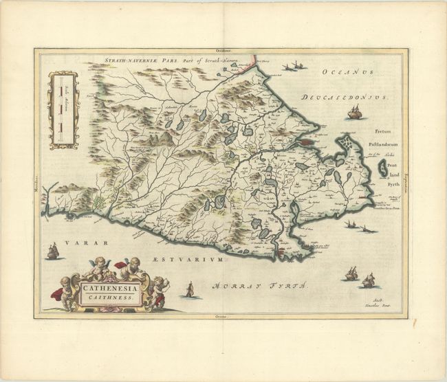
This beautifully engraved map covers the northern tip of Scotland. The map, based on the work of Timothy Pont, famous surveyor of Scotland in the late sixteenth century, includes great detail of the rivers, cities, villages, and castles, including the castle of Old Wick. The fortified city of Thurso is also shown. The title cartouche features putti with surveying instruments. This is the second state with the addition of ships and a cartouche surrounding the distance scale. Latin text on verso.
Publication of Bleau’s atlas of Scotland (Atlas Novus, Volume V) in 1654 was a landmark publication in cartographic history. Most of the maps were based on the surveys of Timothy Pont, which had been done half a century earlier. The publication took over seven decades to bring to publication; it was delayed by wars, copyright restrictions, and only intermittent official support. The maps are scarce today due to the relatively short publication history of the atlas.
References: Van der Krogt (Vol. II) #5853:2.
Condition: A
A dark impression with full contemporary color on a bright sheet with a large watermark of the god Atlas. There is minor printer's ink residue, a hint of offsetting, and a few tiny edge tears.