Subject: London, England
Period: 1880 (circa)
Publication:
Color: Printed Color
Size:
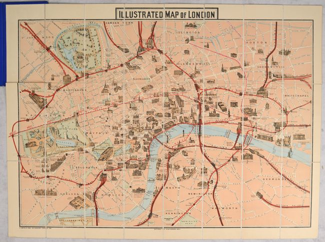
26.8 x 19.3 inches
68.1 x 49 cm
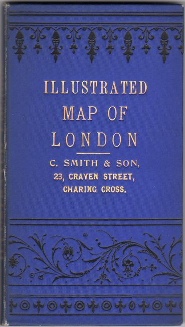
This colorful and decorative map of London extends from Hyde Park (west) to Whitechapel (east) and Islington (north) to Kennington (south). Parks are shaded green, railroad routes are highlighted in red, and numerous important buildings are depicted with a three-dimensional effect including London Tower, St. Paul's Cathedral, Parliament, and Kensington Palace. Complete with original "A Guide to Public Buildings, Theatres, and Places of Amusement" foldout pasted in at front. Hardbound in blue cloth boards with gilt title on the front cover (4.0 x 7.3").
References:
Condition: B+
A clean and colorful example, issued folding, that is backed with linen. There is a long horizontal fold separation running most of the length of the map that has been seamlessly repaired on verso with archival tissue. Covers have minor wear.