Subject: Britain
Period: 1749 (dated)
Publication:
Color: Hand Color
Size:
21.4 x 18.5 inches
54.4 x 47 cm
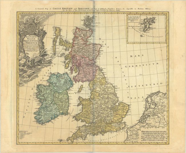
This handsome map of the British Isles includes very good detail of Ireland, England, Scotland, Wales, and the island groups of Orkney and the Outer Hebrides. The map extends to include the adjacent parts of Holland and Belgium with five distance scales below. At upper right the inset chart details the Shetland Islands. A key at lower left includes symbols for cities, towns, villages, universities, forts and redoubts. The large, ornate title cartouche is decorated with a sea monster, shells, a coat of arms and the accoutrements of battle. Titled in English along the top of the map: "A General Map of Great Britain and Ireland with part of Holland Flandres, France, &c."
References:
Condition: B+
Contemporary color on watermarked paper with light toning. The gray shadow along the centerfold is caused by our scanner and doesn't appear on the map itself.