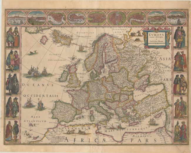
Subject: Europe
Period: 1635 (circa)
Publication: Theatre du Monde ou Nouvel Atlas
Color: Hand Color
Size:
22.1 x 16.3 inches
56.1 x 41.4 cm
This classic map of Europe is presented in the carte-de-figures style with vignettes on three sides. The upper frieze has nine bird's-eye views of Amsterdam, Prague, Constantinople, Venice, Rome, Paris, London, Toledo and Lisbon. The side borders contain the costumes of the noblemen and women of ten European nations. The map is embellished with sailing ships, sea monsters, bears and Neptune riding a dolphin and holding his trident. A beautiful map produced at the height of the Golden Age of Dutch mapmaking; it was included in the first volume of Blaeu's magnificent atlas. French text on verso, published between 1635-38.
References: Goss (Blaeu) #4, p.30; Van der Krogt (Vol. II) #1000:2.
Condition: B
A nice impression with full contemporary color on a sheet with very light toning, a bit of soiling, and a few tiny abrasions. There are professional repairs to a couple of short tears in the figures at left, to a centerfold separation at bottom, and to two chips in the image (1.5 cm x 4 cm at bottom center, and 3.5 cm x 5.5 cm at bottom left) with the image skillfully replaced in facsimile.