Subject: North Atlantic
Period: 1855 (dated)
Publication:
Color: Black & White
Size:
39.5 x 27.2 inches
100.3 x 69.1 cm
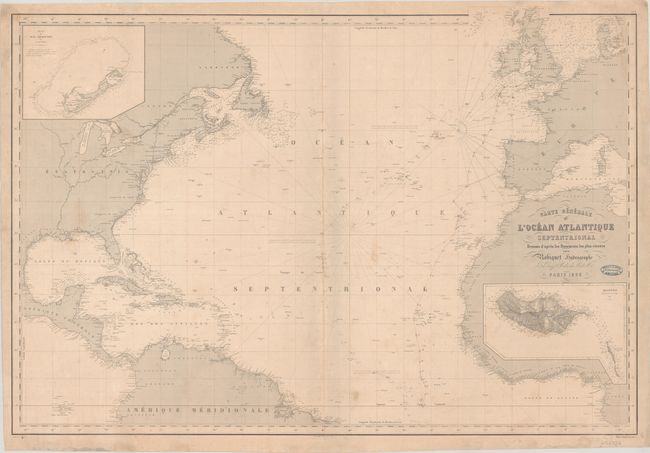
This scarce French sea chart covers the North Atlantic. There is plenty of useful navigational information, including soundings and notes on the winds. Place names line the coasts, but the inland areas are mostly blank, although major rivers are delineated in the United States and Canada. It extends to show the Galapagos, the North Sea, and islands in the Mediterranean. The inset of Bermuda at top left is based on the hydrographic survey begun by Thomas Hurd in 1789, the first complete scientific survey of the island. Another inset at bottom right shows Madeira as surveyed by Alexander Thomas Emeric Vidal. Engraved by Leclerq. Includes the stamp of "Francois Roux - Hydrographe - Marseille." Contemporary catalogue of additional Robiquet charts is attached to verso. Price of "Quatre Francs" appears below the neatline at bottom right.
References:
Condition: B+
The chart is lightly soiled with small stains and manuscript pencil notations. Several small edge tears and chips have been professionally repaired on verso. The map was stored rolled and does not lay flat on its own.