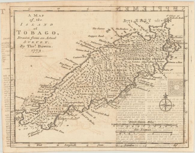
Subject: Tobago
Period: 1779 (dated)
Publication:
Color: Black & White
Size:
9.5 x 7.6 inches
24.1 x 19.3 cm
This small, attractive map is fully engraved with much detail on the island. The island is partitioned into seven divisions, each identifying the number of acres and estates. Near Rocky Bay is a notation about the location of King Roufsels People, referring to a small group of Amerindians, the remaining indigenous people of Tobago. Soundings and shoals mark the harbors, and the map is oriented with a nice compass rose. Published in the December 1778 issue of Gentleman's Magazine.
References: Jolly #GENT-262; Sellers & Van Ee #2112.
Condition: B
Issued folding with light offsetting of the map and moderate offsetting from an opposing page of text.