Subject: Gulf of Mexico & Caribbean
Period: 1782 (published)
Publication: A New System of Modern Geography...
Color: Hand Color
Size:
20.9 x 11.3 inches
53.1 x 28.7 cm
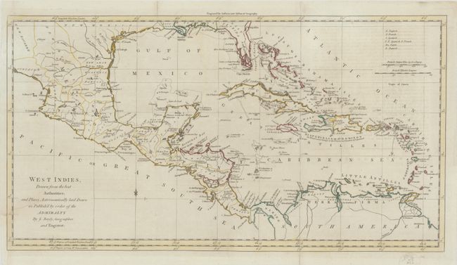
This uncommon map is color-coded to show the colonial possessions of the English, French, Spanish, Dutch, and Danish in the region. Florida is divided into West and East Florida, and the southern tip is fragmented into an archipelago. The landing place of Hernando de Soto is located along Florida's western coastline. Present-day Texas is labeled New Mexico. The various states of Mexico are identified. This map appeared in the 1782 edition of William Guthrie's New System of Modern Geography.
References: McCorkle (18th C. Geography Books) #182-19.
Condition: B+
Issued folding with contemporary outline color. There is an archivally repaired tear that enters 2" into map image at left, minor offsetting from an opposing page of text, and a couple short fold separations confined to the margins that have also been repaired on verso.