Subject: Gulf of Mexico & Caribbean
Period: 1600 (published)
Publication: Tabulae Geographicae Contractae
Color: Black & White
Size:
4.9 x 3.4 inches
12.4 x 8.6 cm
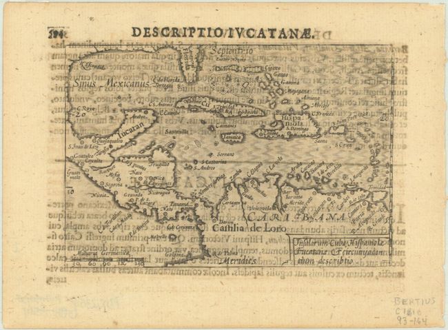
This is the only miniature map of the Gulf of Mexico and Caribbean that was published in the late sixteenth to early seventeenth centuries. The reason is likely because most of these miniature atlases were based on Ortelius, who did not include a map focused on this region in the Theatrum Orbis Terrarum. However it is interesting that this map was created for the Map-treasury despite being a region that was not commonly depicted at the time. The map includes the southern coast of the future United States with Florida and Canaveral labeled. More place names appear in Mexico, Central America, and South America. Latin text on verso.
The map was first published by Cornelius Claesz and printed by Barent Langenes in the 1598 edition of the popular Map-treasury. For the 1599 edition, graduation lines and latitude numerals were added to one side of the border on most of the maps, which were again used for multiple editions through 1650. This is the second state with the added graduation lines from a Latin edition, with new text by Bertius and published by Cornelius Claesz.
References: King (2nd ed.) pp. 80-82; Van der Krogt (Vol. III) #9500:341.
Condition: B+
Dark impression with show through of text on verso. Small remnants of hinge tape on verso.