Subject: Portobelo, Panama
Period: 1757-66 (circa)
Publication:
Color: Hand Color
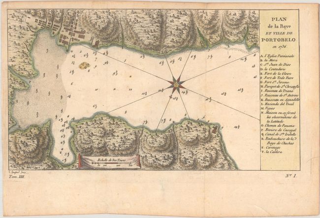
A. Plan de la Baye et Ville de Portobelo en 1736, by Jacques Nicolas Bellin, from Histoire Generale des Voiages ... Tome Cinquantieme, published 1757 (9.2 x 5.1"). This is a slightly reduced version of Bellin's chart of Portobelo Bay. It shows Portobelo, the important Spanish port city on the northern coast of Panama. Numerous soundings are located, and a key at right identifies important locations. It is based on the plan by Antonio de Ulloa and Jorge Juan, first published in 1752. Not listed in Kapp's carto-bibliography of Panama. Engraved by Elisabeth Haussard, best known for her work for the Robert de Vaugondy family. Condition: A crisp impression issued folding, now flat, with minor foxing and offsetting.
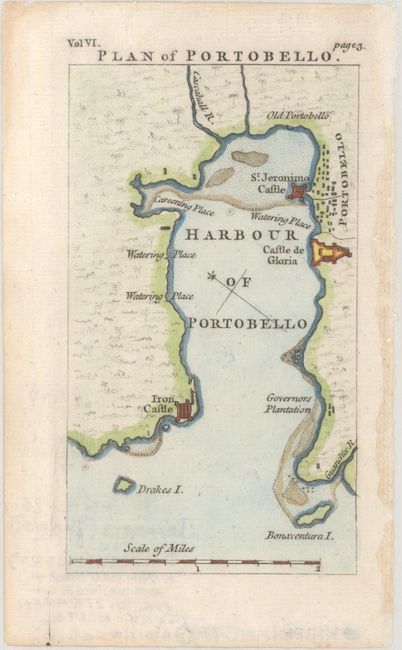
B. Plan of Portobello, by Thomas Jefferys, from A Compendium of Authentic and Entertaining Voyages... Vol. VI, circa 1766 (3.0 x 5.3"). This small map of the harbor of Portobelo locates Iron Castle, Governors Plantation, Castle de Gloria, St. Jeronimo Castle, and Old Portobello. The city of Portobelo is shown in basic plan form. Condition: A crisp impression.
References:
Condition: A
See description above.